
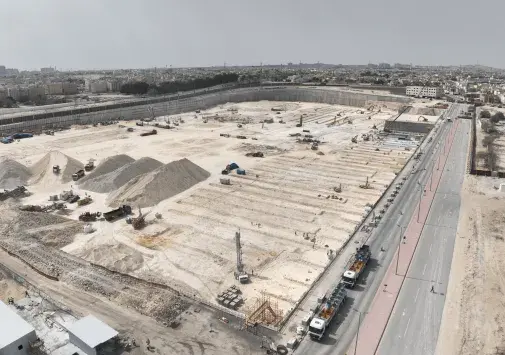
Aerial surveying with drones isn't about a nice photo from above. It's about turning a whole site — a development plot, a quarry, a road corridor, a project zone — into precise spatial data you can measure and build on: a unified map, an elevation model, and a 3D point cloud. This article explains what a mission actually produces, how it runs from planning to delivery, and when a survey reaches the accuracy an engineer can trust.
What a mission produces
- Orthomosaic: hundreds of images stitched into one geometrically corrected map where every pixel sits at its true ground position, so you can measure directly on it.
- Digital Surface Model (DSM) and Digital Terrain Model (DTM): they describe the elevation of every point on site, with or without buildings and vegetation.
- 3D point cloud: millions of georeferenced points that rebuild the site as a solid model for measurement and design.
- Contour lines and quantity take-offs: for cut-and-fill and stockpile volumes, extracted automatically from the model.
How a mission runs on the ground
Accuracy is built before take-off. A mission starts with an automated flight plan that guarantees enough overlap between images — typically 70% forward and 60% side — because every ground point must appear in several photos for the software to reconstruct it in 3D. We place ground control points (GCPs) measured with a precise survey instrument; they are the reference that locks the entire survey onto real-world coordinates. The drone then flies the plan at a fixed altitude that sets the required ground pixel size (GSD).
Accuracy: when is a survey ‘survey-grade’?
Not every aerial map is fit for engineering design. The difference between an illustrative survey and a survey-grade one is ground control and positioning method. A survey backed by GCPs or RTK/PPK — where each image's position is corrected to centimetre level — reaches horizontal and vertical accuracy sufficient for roadworks, grading, and quantity calculation. Always ask a provider for an accuracy report documenting the residual error on independent checkpoints; a clear number, not a vague promise.
Use cases in the Saudi market
- Land development: a precise site survey before design saves weeks of traditional ground surveying.
- Quarries and stockpiles: accurate, periodic material-pile volumes for inventory tracking and billing.
- Infrastructure: surveying road corridors and utility lines, with elevation models fed straight into design software.
- Progress monitoring: repeat surveys comparing as-built against the plan to track quantities and progress.
Have a site you need surveyed to an accuracy engineering can trust? Get in touch — we'll define the right accuracy for your purpose and hand you data ready for design software, not just pictures. Learn more about our aerial mapping service.